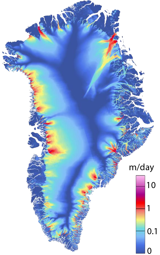
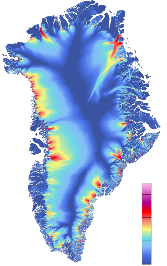
Ice Sheet Velocity
Comprehensive Ice velocity observations are essential for estimating ice sheet discharge and mass balance and are key input for modelling ice dynamic processes in response to climate warming. Based on Sentinel-1 SAR imagery we generate high-resolution ice velocity maps at 50 m posting over the ice sheets by combining SAR interferometry (InSAR) and offset-tracking (OT). The InSAR method provides improved accuracy particularly in the slow-moving interior of the ice sheets at higher resolution but requires crossing satellite acquisitions as well as image pairs with adequate coherence. On zones without crossing orbits our processing line uses the velocity vector derived from INSAR and flow direction from OT to optimally fill in gaps. Fast moving areas where coherence is not preserved are filled with OT velocity observations. The added value of the new ice velocity maps is assessed by intercomparison with operational ice velocity products and in-situ GPS data. Significant improvement compared to current products are achieved in interior parts of the ice sheets, for example helping to better constrain boundaries between ice drainage basins.
This section was taken from here or equivalently from here.This work was done under the ESA Greenland Ice Sheet Climate Change Initiative (CCI) and the ESA EXPRO+ project (Phase-based Sentinel-1 Ice Velocity). You can read more about the ESA Greenland Ice Sheet CCI here.
Taken from Nagler, Thomas & Libert, Ludivine & Wuite, Jan & Hetzenecker, Markus & Keuris, Lars & Rott, Helmut. (2022). Comprehensive ICE Sheet Wide Velocity Mapping Combining SAR Interferometry And Offset Tracking. 3888-3891. 10.1109/IGARSS46834.2022.9884206.