Ice and Snow in the European Alps
AlpSnow falls under ESA's Alpine Regional Initiative as a scientific endeavor dedicated to advancing the development of innovative Earth Observation (EO)-based products tailored to meet both scientific and operational requirements in the Alpine region. Its primary focus lies in pioneering EO algorithms and methodologies to craft the most comprehensive and coherent depiction of snow, encompassing its behaviors and attributes. The following snow-related parameters are the core of its exploration, harnessing the capabilities of both SAR and optical satellite data:
- Snow area coverage
- Snow reflectivity (albedo)
- Snow water equivalent
- Snow depth
- Snow grain size
- Presence of liquid water content in snow (wet snow)
AlpSnow operates under the umbrella of the Scientific Data Exploitation Element within ESA's EOEP-5 initiative. This effort is designed to cater to the evolving needs of the EO and Earth system science communities by advancing innovative methods and products and fostering the development of accessible scientific tools.
You can read more about the AlpSnow project here and here (official).
ESA has highlighted the importance of the LAMSU method in an article on this page.
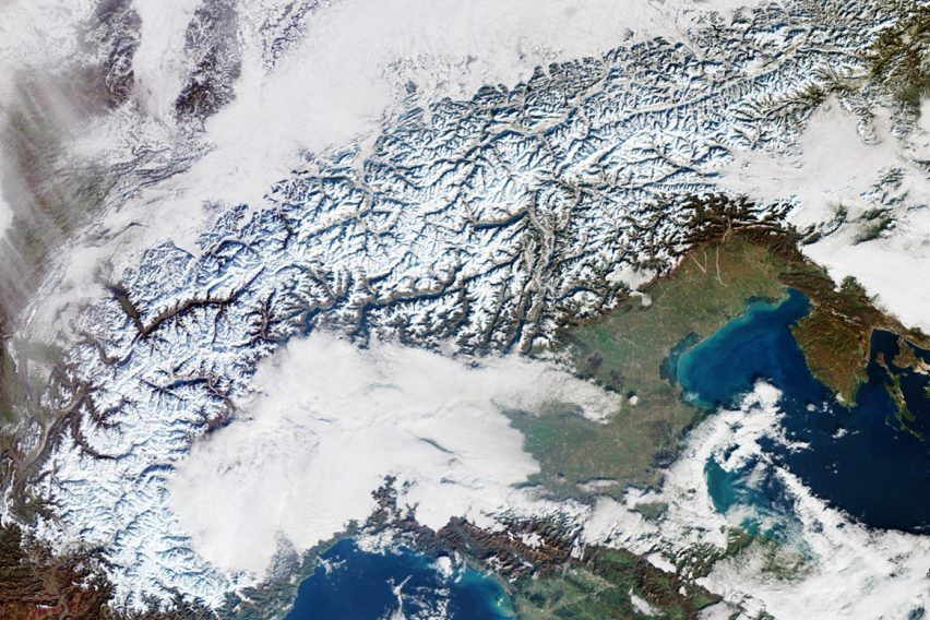
The image above reveals some of the complexity involved with classification tasks with remote sensing data acquired from space.